GEOGRAPHIC INFORMATION SYSTEMS
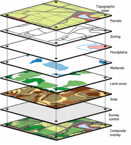
The GIS Department analyzes spatial information and provides data visualization using maps, graphs, and 3D scenes. The department is tasked to interpret field data by identifying patterns and relationships in order to help guide the decision making process. By utilizing GIS software, the District is able to identify problems, monitor change, understand trends, create predictive models and respond to events.
DETERMINING HOW PLACES ARE RELATED
- Understanding where and when things change
- Analyzing variations and patterns
- Determining overlapping relationships in space and time
- Summarizing what is within an area(s)
- Finding the best allocation of resources to geographic areas
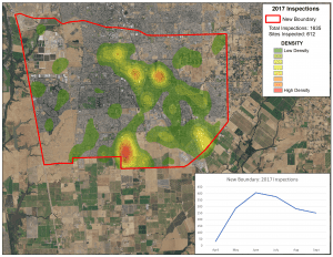
DETECTING AND QUANTIFYING PATTERNS
- What are the local and regional spatial trends?
- Where are the significant hot spots and outliers?
- Are spatial patterns changing over time?
- Calculating geometries and distribution of features
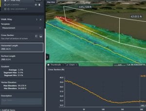
MAKING PREDICTIONS
- Predicting where phenomena will move, flow, or spread
- Finding factors that explain spatial patterns and making predictions
- Predicting how and where objects spatially interact
- Terrain modeling and surface creation
THE DISTRICT AT A GLANCE